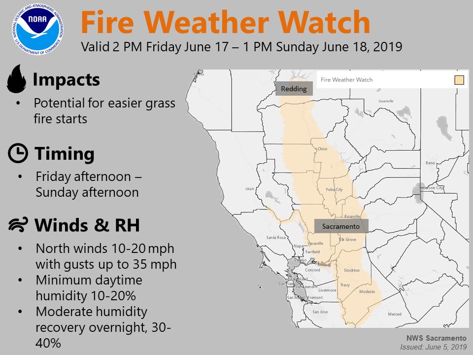
Breezy North Winds and Low Relative humidities Friday afternoon through Sunday…
The National Weather Service in Sacramento has issued a Fire Weather Watch, which is in effect from Friday afternoon through Sunday afternoon.
Well above average temperatures have allowed grasses in the valley to dry and become receptive to fire. Behind the cooling later this week, breezy north winds will develop over the valley and adjacent foothills Friday afternoon and continue into Sunday.
Humidities will be low during the day, with poor recoveries overnight.
While the foothills will see breezy winds, and lower humidities, the fuels are green enough that threat of rapid spread is not expected. Therefore, only locations below 1000 feet are included in the Fire Weather Watch.
FIRE WEATHER WATCH IN EFFECT FROM FRIDAY AFTERNOON THROUGH SUNDAY AFTERNOON FOR NORTH WINDS AND LOW HUMIDITIES FOR FIRE WEATHER ZONES 215, 216, 217, 218, AND 219.
The National Weather Service in Sacramento has issued a Fire Weather Watch, which is in effect from Friday afternoon through Sunday afternoon.
AFFECTED AREA…Sacramento and San Joaquin valley Fire weather zones 215, 216, 217, 218 and 219.
* WIND…North wind 10 to 20 mph with gusts to 35 mph, decreasing to 5 to 15 mph overnight.
* HUMIDITY…Minimum humidity 10 to 20 percent during the day, moderate recoveries overnight of 30 to 40 percent.
* HIGHEST THREAT…is located in the western Sacramento valley where the highest wind gusts are expected
* IMPACTS…any grass fires that develop will likely spread rapidly. Outdoor burning is not recommended.
www.facebook.com/nws.sacramento
www.twitter.com/nwssacramento


